How do sentinel data help underground gas storage monitoring in Germany?
GermanyGronau-Epe, on the German-Dutch border, is Europe’s largest underground gas storage site. A kilometre beneath its fields, 114 salt caverns hold natural gas, crude oil, brine, and helium for ten operators. Creating and operating the caverns makes the ground above move, slowly but measurably, which can affect wells, pipelines, watercourses, and property.
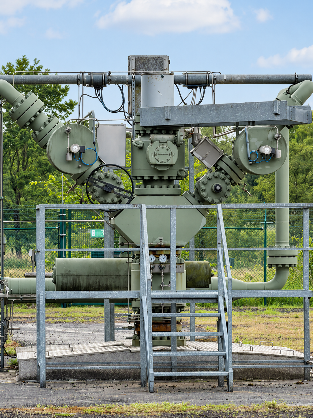
The Challenge
German mining law requires an annual levelling survey, which measures vertical movement once a year at a fixed set of benchmarks. It cannot follow movement across the whole 25-square-kilometre field, misses the horizontal motion that affects pipelines, and misses movements between surveys. After an oil leak in 2014, residents also wanted an independent record of what happens beneath them.
In 2014 a leak from an oil cavern released 200,000 litres of crude oil, led to the resettlement of a farm, and cost a double-digit million-euro sum to remediate.

The Solution
Copernicus Sentinel-1 satellites carry a radar that images the ground through cloud, by day and by night. Comparing repeated images of the same area with radar interferometry (InSAR) measures ground movement of a few millimetres. Over Gronau-Epe, new images arrive every week, and because the satellites pass on both ascending and descending orbits, vertical movement can be separated from east-west horizontal movement on a 30-metre grid. The method measures farmland and bog as densely as built-up areas, so it covers the whole 25-square-kilometre field.
The archive of more than 760 scenes reaches back to December 2015, so the movement history of any location can be reconstructed on demand. That long record helps separate drought-driven movement from movement caused by cavern operations. Because the data are free and open, monitoring of this scale and duration is affordable.
Description of the value chain
Tier 1
EFTAS | Service provider
Weekly Sentinel-1 radar monitoring of ground movement across the Gronau-Epe cavern field, with an archive back to December 2015.
Tier 2
Uniper | Primary user
Gas storage operator using area-wide ground-movement assessments to manage integrity risk across its 39 salt caverns.
Tier 3
Customers and gas owners | Secondary User
Gas storage and trading at Gronau-Epe, with better-informed integrity management of 16.9 TWh of working gas.

Tier 4
Citizens and Society | Societal beneficiaries
An independent public record of ground movement, greater trust in the operators, and a lower risk of incidents and environmental damage.
Other
beneficiaries
Key takeaways
- Weekly, area-wide ground-movement monitoring of 114 caverns
- Vertical and horizontal motion, with a record back to 2015
- Drought effects separated from cavern operations
- A service made viable by free Sentinel-1 data
- A shared public record that helps build trust
The Benefits of using Sentinel data
Economic benefits
Free Sentinel-1 data save EFTAS a commercial radar-data cost of €100,000 to €180,000 a year, without which the service would not be viable. For Uniper, comparable information from conventional terrestrial monitoring would cost an estimated €250,000 to €450,000 a year. A second estimate, the expected loss from major cavern incidents that earlier detection could avoid, gives around €52,000 a year and is shown for context only. The monitoring also helps protect €500 to 900 million of stored gas, the value at stake rather than a benefit.
€350,000–630,000 a year in recurring quantified benefits across the chain
Environmental benefits
Radar monitoring gives earlier warning of ground movement that could signal leakage risks to the raised bogs, watercourses, and protected habitats above and around the field. It also supports ongoing monitoring for divergence from the environmental baseline. The analysis showed that drought, not cavern operations, drove much of the observed subsidence: at the subsidence maximum, movement of around 2 cm a year rose to around 3 cm in the dry year 2022. Annual levelling could not have shown this.
Innovation and entrepreneurship
EFTAS combined SBAS interferometry with K-means clustering and a multi-criteria analysis of more than 15 open geodatasets in one operational product. The work has become a new product line in underground storage monitoring, and a first invitation to a nearby ground-damage case came from the Epe reference. The research cooperation is the first in German mining to take a citizens’ initiative as a scientific partner. EFTAS states that the service would not be viable if the radar archive had to be bought.
Around a fifth of EFTAS’s business now comes from SAR ground-motion services
Regulatory benefits
The service complements the annual levelling survey required under the German Federal Mining Act, and the mining authority has welcomed the additional information. The German mine surveyors’ association revised its radar interferometry guidelines in January 2025, and standardisation is under way. Under EU resilience rules, German storage operators must run all-hazard risk assessments from 2027, which satellite ground-motion monitoring directly supports. InSAR is already accepted in statutory monitoring in the Netherlands and Italy.
2027: all-hazard risk assessments become mandatory for gas storage operators
Scientific and technical benefits
The methodology is published in two peer-reviewed papers in the journal Mining and was presented at INTERGEO 2025 and the 13th Deutsches GeoForum. A separate research group resolved the site’s movement independently with Sentinel-1, separating cavern convergence from pressure-cycle movement of up to ±6 mm and from groundwater-driven soil dynamics, in good agreement with the mine surveyor’s levelling. The REWE 2.0 follow-on project (2026/2027) adds an AI layer and the 2024 3D seismic survey.
Societal benefits
The research cooperation helps build trust between operators and a community marked by the 2014 oil leak. Residents have an independent, public record of ground movement at monitoring-epe.de, explained through public events, an excursion, and an award-winning school project. Statutory levelling produces a handful of unpublished benchmark readings a year, so this public visibility depends on the Sentinel-based service. The monitoring also protects the availability and public acceptance of Europe’s largest cavern storage field.
59% of citizens surveyed wanted more information on the cavern-field monitoring
More about the study
This case study was conducted as part of the ESA-funded SeBS360 project, led by Evenflow, which assesses the value generated through the use of Copernicus Sentinel data across the value chain. Benefits are identified and assessed through a multidimensional value framework, enabling the systematic consideration of the different benefits arising from the use of Sentinel data. The methodology combines qualitative and quantitative evidence, recognising that not all benefits can be reliably monetised. The assessment establishes a baseline and a counterfactual, representing what would likely have occurred without the use of Sentinel data. The Sentinel-enabled approach is then compared with alternative methods or previous practices to determine the added value attributable to Sentinel data.
Disclaimer: The views expressed in this case study are those of the authors and cannot in any way be taken to reflect the official opinion of the European Space Agency.