How does Sentinel-1 monitor Colombia’s power grid?
ColombiaColombia’s high-voltage electricity transmission network is part of the national infrastructure connecting power generation with households, businesses and essential public services. Its transmission corridors cross the Andes, where steep terrain, intense rainfall and active geological processes shape the environment in which electricity infrastructure is built and operated.
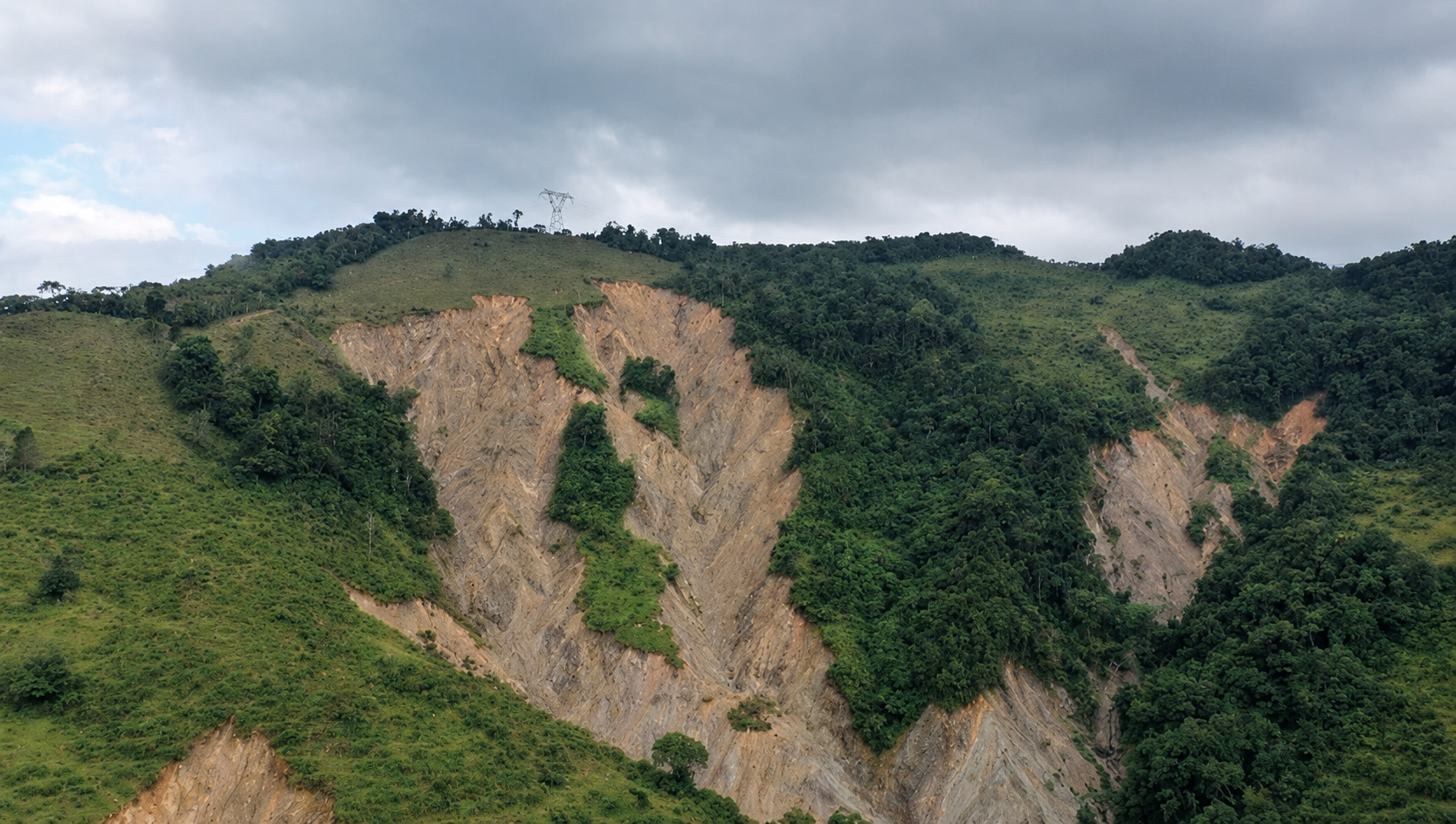
More than 80% of Colombia’s population is exposed to high or very high landslide hazard.
The Challenge
Ground instability can affect individual towers or slopes while other sections remain stable. Physical inspections are essential but difficult to repeat across long, remote corridors and provide no continuous monitoring. Infrastructure managers therefore need to identify where ground movement is occurring and where further inspection and engineering attention are needed.
30,730 landslides were recorded in Colombia between 1900 and 2018, with 92.5% of rainfall-triggered landslides concentrated in the Andean region.

The Solution
The Sentinel-1-based solution combines free and open C-band radar imagery with satellite radar interferometry (InSAR) to monitor ground deformation along high-voltage transmission corridors. Repeated radar observations are converted into deformation time series and velocity maps, allowing ground movement to be tracked at millimetre-per-year rates across wide areas.
Because Sentinel-1 observations are available regardless of cloud cover or daylight, they provide a consistent historical record for distinguishing stable ground from new or accelerating movement. Areas showing persistent or unusual deformation can then be prioritised for field verification and further engineering assessment, making monitoring more targeted than relying on physical inspections across the entire network alone.
The service is applied across an estimated 2,500–3,000 km of high-voltage transmission lines. Ten critical sectors have been identified; 4 are currently monitored continuously and 6 are planned.
How the service works across the value chain
Tier 1
Detektia Service provider
Sentinel-1 InSAR processing into ground-deformation time series over high-voltage transmission corridors.
Tier 2
GeoAndina Primary user
Interpretation of the deformation data into engineering recommendations and improved inspection methods.
Tier 3
GEB / Enlaza Secondary User
Inspection, maintenance and intervention decisions that protect the transmission network from terrain-driven failure.

Tier 4
Citizens and Society | Societal beneficiaries
Reliable electricity supply and fewer outages for the population and economy that depend on the grid.
Other
beneficiaries
Key takeaways
- Wide-area, all-weather ground-deformation screening
- Historical, repeatable monitoring of critical corridors
- Targeted field inspections where movement is detected
- More preventive, evidence-based infrastructure management
- Greater reliability of the national electricity network
The Benefits of using Sentinel Data
Economic benefits
Using Sentinel-1 avoids approximately €320,000 per year in commercial radar-data costs for an equivalent service. The monitoring approach is also estimated to avoid €5,000–€10,000 per year in field-inspection costs and €24,000–€240,000 per year in expected failure losses across the four continuously monitored sectors. An additional indicative saving of approximately €200,000 per major corridor-planning exercise is reported separately because it is not annualised and is excluded from the combined total.
Illustrative combined annual economic benefit: €350,000–€570,000
Environmental benefits
Monitoring may help reduce wildfire-ignition risk by preventing terrain-driven line failures. This pathway is plausible in Colombia, but it has not been demonstrated for the monitored corridors.
Potential benefit; not yet demonstrated
Innovation and entrepreneurship
Free and open Sentinel-1 data are fundamental to Detektia’s business model. The company reports that approximately 90–95% of its data comes from Sentinel-1 and that it would probably not exist without access to free Copernicus data. This lowers barriers to entry for SMEs, supports skilled engineering jobs and enables the development of award-winning InSAR algorithms, including those recognised through the 2024 Cassini Challenge. For GeoAndina, integrating InSAR into geotechnical workflows supports a shift from reactive to predictive engineering and reinforces its position as an early adopter of satellite-based monitoring.
Sentinel-1 helps turn satellite data into new services and more predictive engineering.
Regulatory benefits
Sentinel-enabled monitoring can help asset owners manage exposure to CREG-regulated charges associated with network unavailability and unsupplied energy. Objective ground-deformation records could also inform future force-majeure assessments.
Better evidence to support regulatory risk management.
Scientific and technical benefits
Beyond this contract, the organisations involved contribute to peer-reviewed Earth Observation research, technical congresses such as CIMGA, and professional training through Detektia’s InSAR Academy. These activities help spread InSAR expertise beyond this powerline project.
InSAR expertise extends beyond the project.
Societal benefits
More reliable electricity transmission infrastructure supports households, businesses and essential public services across Colombia. In 2024, national electricity coverage reached 93.12% of dwellings. The monitored corridors form part of the interconnected system that supports this supply. As Grupo Energía Bogotá is substantially publicly owned, protecting its infrastructure also helps safeguard public investment.
A grid serving a country where over 93% of dwellings have electricity access
More about the study
This case study was conducted as part of the ESA-funded SeBS360 project, led by Evenflow, which assesses the value generated through the use of Copernicus Sentinel data across the value chain. Benefits are identified and assessed through a multidimensional value framework, enabling the systematic consideration of the different benefits arising from the use of Sentinel data. The methodology combines qualitative and quantitative evidence, recognising that not all benefits can be reliably monetised. The assessment establishes a baseline and a counterfactual, representing what would likely have occurred without the use of Sentinel data. The Sentinel-enabled approach is then compared with alternative methods or previous practices to determine the added value attributable to Sentinel data.
Disclaimer: The views expressed in this case study are those of the authors and cannot in any way be taken to reflect the official opinion of the European Space Agency.