Urban Heat Island Mitigation for a park in Ireland
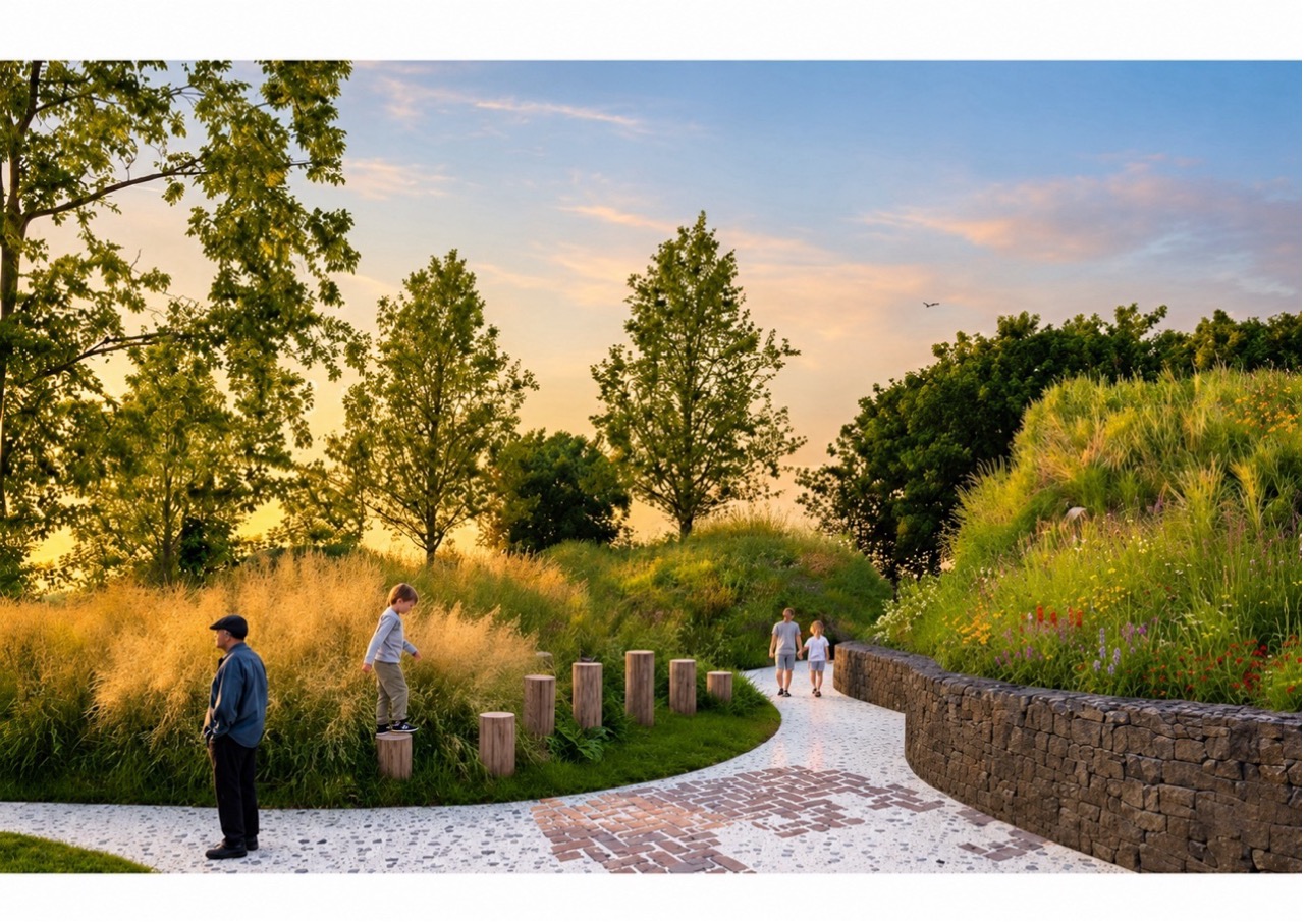
IrelandSandyford Business District in south Dublin is a largely built-up landscape of roofs, roads and car parks, where a growing residential population now lives alongside thousands of workers. Under the Interreg IB-Green project, the district plans to turn 0.8 hectares of industrial land into a civic park designed to improve the quality of life in the area and reduce urban heat. In order to optimise the design of the park, and in absence of a pre-existing urban heat dataset, Sandyford District used Latitudo 40, an Italian EO company, to compare tree cover and greening across the district and simulate how different park designs would cool the area before anything was built, giving planners evidence that had not existed before. Sentinel-2 data is central to the simulator: its 10 m resolution imagery is used to sharpen coarser Landsat thermal data to a level of detail fine enough for designing the park.
The Challenge
An urban heat island (UHI) is a built-up area that is significantly warmer than its rural surroundings, as surfaces such as asphalt and concrete trap heat and transport and air conditioning add more. Higher temperatures raise energy demand and emissions, worsen air pollution and increase heat-related illness among vulnerable groups such as elderly people. Trees and green spaces can reduce these effects.
When designing its new green space, Sandyford Business District looked for evidence about the environmental conditions of the park area but had no public historical dataset to draw from. Sensor or drone surveys could have been deployed but these could only measure current conditions and would not provide historic heat trends. Satellite data were called upon to fill this gap.
The EU’s Joint Research Centre recommends more green infrastructure to mitigate urban heat, noting that a study of more than 600 European cities found urban trees lower air temperature by 0.8 degrees on average.

The Solution
Italian Earth observation company Latitudo 40 combined Sentinel-2 data with Landsat 8/9 thermal data. Sentinel-2 has no thermal sensor, but its free 10 m imagery captures surface features that drive heat, such as vegetation and sealed surfaces. Machine-learning algorithms use this detail to downscale Landsat thermal data into 10 m land surface temperature maps, producing heat island and tree cover layers for Sandyford. Sentinel-2 also provides the land-cover map on which each simulated scenario is built. Multi-year, wide-area coverage gave a consistent picture of typical conditions across the district and its surroundings. These outputs were also shared through Sandyford’s proprietary digital twin to communicate the design to residents, businesses and the council.
Three greening scenarios for the planned park were simulated, that would lower the simulated average summer surface temperature by 1.58°C, 2.10°C and 3.96°C respectively. Sandyford chose Scenario 2, balancing cooling with open space and other amenities for people to use. Once operational, the Copernicus Land Surface Temperature Monitoring (LSTM) mission (expected around 2028) will add direct thermal observations at around 50 m every 1–3 days, allowing the cooling effect of the built park to be verified rather than only modelled, and reducing reliance on non-Copernicus thermal data.
Sentinel-enabled analysis improved the evidence base, scenario-comparison capability and communication of the urban-greening decision.
Description of the value chain

Tier 1
Latitudo 40 | Service provider
Uses heat maps and scenario simulations to inform the civic park design under the IB-Green project, support climate risk analysis and communicate design options to stakeholders through its digital twin.
Tier 2
Sandyford Business District | Primary User
Uses heat maps and scenario simulations to inform the civic park design under the IB-Green project, support climate risk analysis and communicate design options to stakeholders through its digital twin.

Tier 3
Organisations in Sandyford | Secondary User
Companies, employers and property owners gain a cooler, more attractive district, with potential energy savings, employee wellbeing, business attraction and property value benefits once the park is built.

Tier 4
Citizens and Society | Societal beneficiaries
Residents, workers and visitors gain cooler, usable green space, lower heat-related health risks, more biodiversity and a more climate-resilient district in which to live, work and spend time.
Other
beneficiaries
Key takeaways
- Historical district-wide heat evidence where non existed before
- Greening scenarios compared before construction
- Park design balancing cooling and usable space
- Clearer stakeholder communication via a digital twin
- A low-cost, replicable approach for European cities
The Benefits of using Sentinel data
Economic
Sentinel data make this type of analysis affordable and replicable. Free and open Copernicus imagery saved Latitudo 40 commercial imagery costs, while the historical multi-year evidence base reduced Sandyford’s risk of a sub-optimal park design. The Sentinel-attributed benefit is estimated at €6,500–€13,000 for this single 0.8-hectare park, and an indicative €19,500–€39,000 per year if applied to around three comparable Irish projects annually. These figures are deliberately conservative: the park is small and Ireland sits at the conservative end of the spectrum for this kind of valuation, given its temperate climate. Future energy, property and health-related benefits therefore remain unpriced in this analysis. Sandyford should be read as a conservative indication of the value of Sentinel data in this context, rather than as a representative figure for similar initiatives in warmer climates.
€6,500–€13,000 in estimated economic benefits for a single 0.8-hectare park in Ireland
Environmental
The environmental benefits could be the most significant once the park is built. Its design aims to cool surrounding streets, promote biodiversity and reduce reliance on air conditioning and associated emissions. Simulations indicate a 2.1°C reduction in average summer land surface temperature, strengthening resilience to heatwaves. These potential gains also support the council’s climate adaptation and green infrastructure commitments and the EU Nature Restoration Law.
Simulations indicate that the chosen design could reduce average summer land surface temperature by 2.1°C, strengthening resilience to heatwaves.
Innovation and entrepreneurship
Latitudo 40’s Urban Simulator combines Sentinel data, geospatial intelligence and AI to model interventions that do not yet exist, shifting the service from static mapping to decision support. This scenario-comparison capability was the decisive factor in Sandyford choosing Latitudo 40 over manual surveys or drone mapping. Sandyford also integrated the satellite-derived layers into its digital twin, turning complex heat and greening data into visuals for residents, workers and businesses. Free and open Copernicus data also let Latitudo 40 grow internationally without relying heavily on costly commercial imagery.
Sentinel-powered simulations enable smarter urban planning decisions and support scalable innovation.
Regulatory
The evidence produced supports Dún Laoghaire-Rathdown County Council in demonstrating progress against its climate adaptation, green infrastructure and biodiversity commitments, including local climate and development plans. At EU level, IB-Green’s heat-mitigation evidence contributes to the EU Adaptation Strategy, Nature Restoration Law and ERDF reporting, strengthening the shared European evidence base on urban heat in business parks.
Supporting local and EU climate adaptation commitments through evidence-based urban planning.
Science & Technology
Latitudo 40’s machine-learning algorithms downscale thermal data using Sentinel-2’s 10 m imagery, and a Super Resolution algorithm can enhance Sentinel-2 imagery to 1 m. Several staff, including PhD holders and the CTO, have authored peer-reviewed Earth observation publications. The approach shows how Copernicus data can be fused with other open missions, such as Landsat, to deliver products at a resolution neither provides alone.
10 m land surface temperature maps can be produced by combining Sentinel-2 and Landsat data.
Societal
The planned civic park aims to provide cooler, more comfortable recreational spaces for Sandyford’s workers and growing residential population, while reducing heat-related health risks and supporting wellbeing and community cohesion. Local businesses could also benefit from a more attractive working environment. The satellite-based urban simulator informed the park’s design, while satellite-derived visuals supported public consultation and helped build support for a shared community space.
A greener, cooler public space designed to improve wellbeing, encourage social interaction and strengthen community cohesion.
More about the study
This case study was conducted as part of the ESA-funded SeBS360 project, led by Evenflow, which assesses the value generated through the use of Copernicus Sentinel data across the value chain. Benefits are identified and assessed through a multidimensional value framework, enabling the systematic consideration of the different benefits arising from the use of Sentinel data. The methodology combines qualitative and quantitative evidence, recognising that not all benefits can be reliably monetised. The assessment establishes a baseline and a counterfactual, representing what would likely have occurred without the use of Sentinel data. The Sentinel-enabled approach is then compared with alternative methods or previous practices to determine the added value attributable to Sentinel data.
Disclaimer: The views expressed in this case study are those of the authors and cannot in any way be taken to reflect the official opinion of the European Space Agency.